

Since my last post, the storm continued to trend northward and eventually brought snow, and ice… just a wintry mess to parts of the Mid-Atlantic and interior Northeast - not so much near the I-95 corridor.
I very much like this paragraph written by Firsthand Weather. Things are going to get busy as we enter the heart of El Nino and winter.
“As we progress later into January (just after the 15th-ish), signs point to the potential for the South, including the Deep South, to have the best chances for wintry precipitation in at least several years. The Mid-Atlantic, as well, could enter a wintry period not experienced in several winters.”
But we will miss before we hit.
Expect snow to linger across New England and the Northeast before things clear out by tomorrow morning.
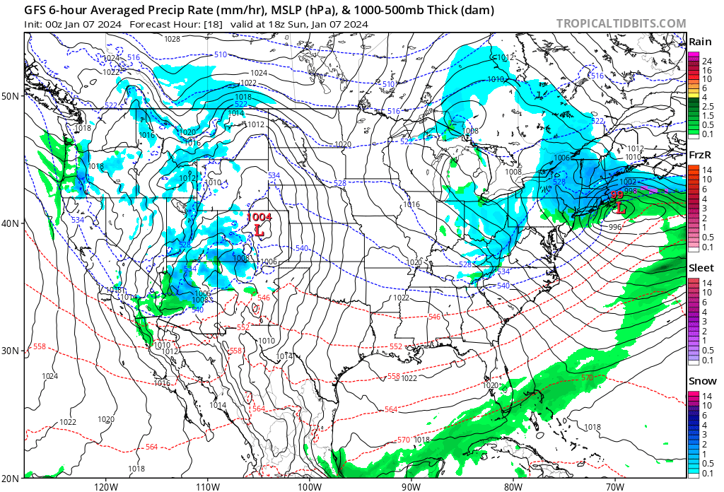
Scattered rain and snow will be present across the West Coast as another system will combine with Gulf of Mexico moisture bringing yet another high-impact storm, this time targeting the Central US.
Big East Coast System Heading into the Week
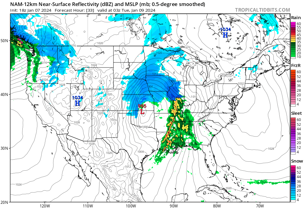
Rain will begin in OK and TX where rain will spread eastward across the state. Snow will begin to move into the Great Plains as this system starts to come together tomorrow morning.
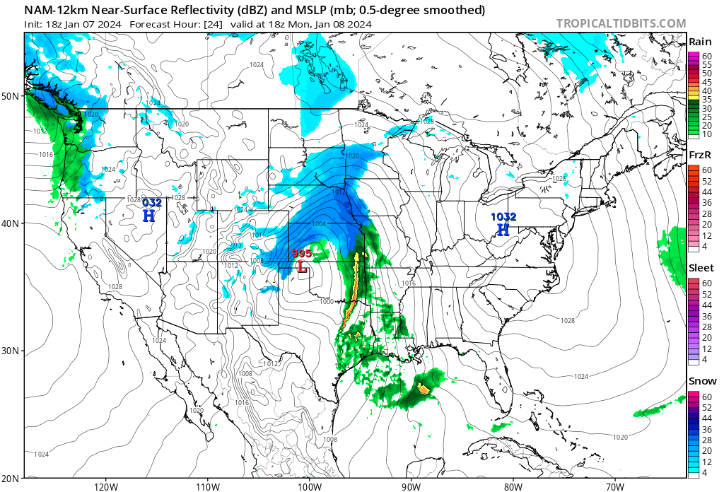
By midday tomorrow, snow could be moving into the Kansas City (possibly rain/snow mix), Des Moines, and Minneapolis metropolitan areas as blizzard conditions on the back end of this storm will be affecting the Oklahoma and Texas Panhandle as well as far northeastern NM, southeastern CO, and much of western KS.
You can see the classic comma head shape already forming.
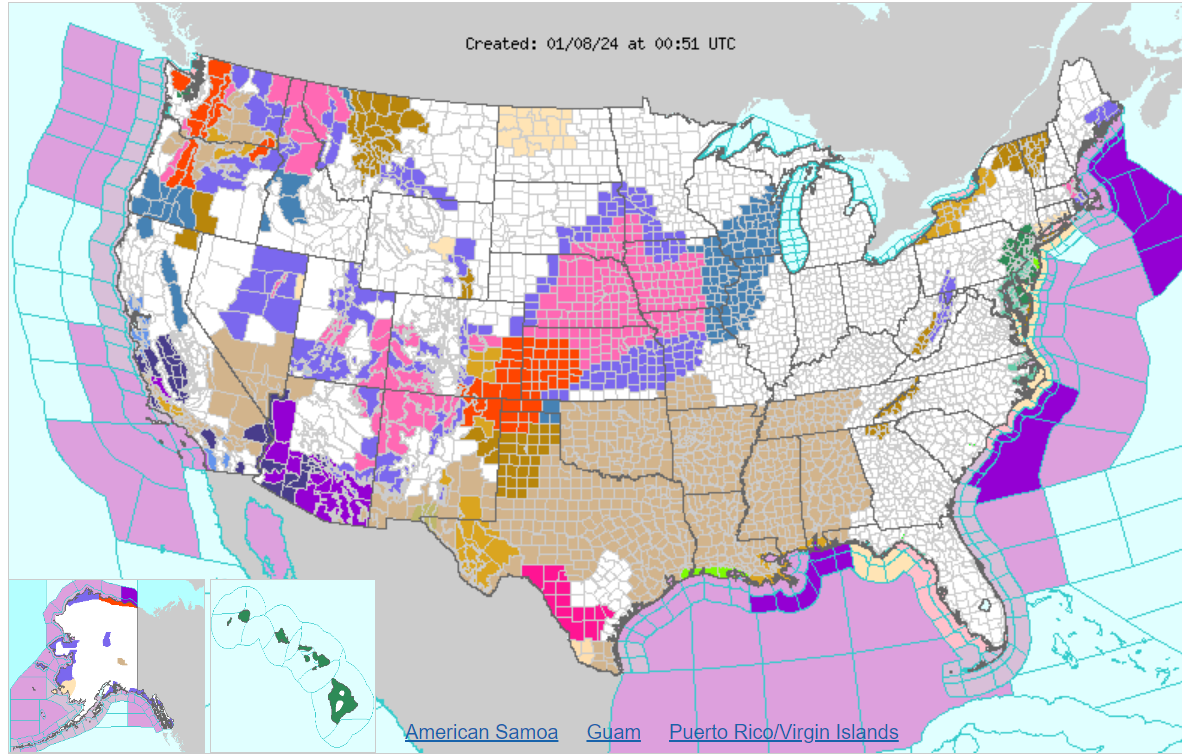
This won’t just be a rainmaker, it will also be a windy one. A huge swath of wind advisories are up for much of the TX/OK and the South. Expect more to be issued up and down the East Coast and some high wind warnings as well in parts of the Northeast and New England. Widespread gusts up to 60mph (more in some areas) can be expected.
The storm will continue to progress eastward bringing high winds and a soaker for the South, snow to the north.
Eventually, this storm will cut northeastward into the Great Lakes region overnight Monday and a severe threat is possible with the very long line of rain and storms moving across the Midsouth.
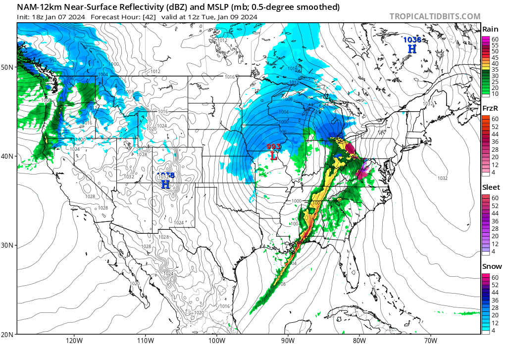
Snow keeps progressing north - some ice even showing up as this system interacts with colder air in the Northeast Tuesday morning. It may start as a brief period of sleet/snow in the mountains of VA and WV and upper Ohio as this storm keeps moving northeast. The northwestern part of the country will also see periods of rain and snow.
Snow will linger on the backside of this storm bringing some snow showers in the afternoon into overnight across the Ohio Valley.
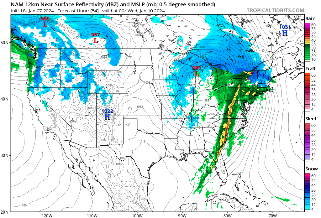
Expect an initial period of snow in Northern PA then transitioning into rain. Soaker and high winds for much of the East Coast as a line of heavy rains passes through. Snow continues to push into New England (NY, Vermont, New Hampshire, Mass, and Maine).
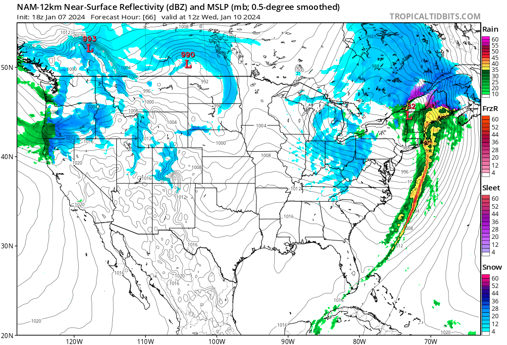
The system will begin to move out Wednesday morning with lake effect and leftover snow showers across the Ohio Valley.
A severe weather threat is also in place - cannot rule out the threat of some tornadoes. An enhanced (moderately widespread severe storms) risk of severe weather is present for Monday and Tuesday as the line of storms moves through late Monday night into Tuesday.
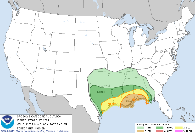
The threat area shifts east the next day targeting the Florida Panhandle.
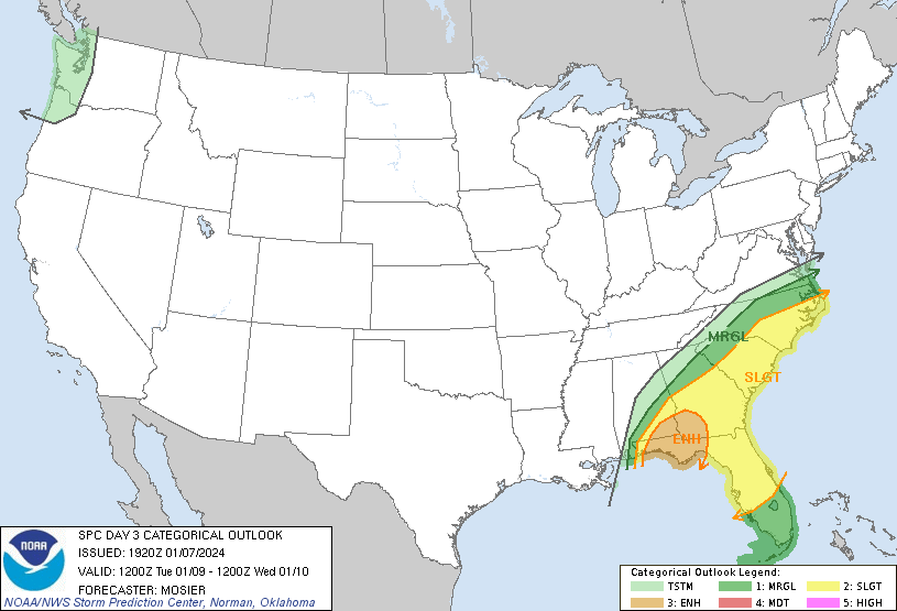
Winds and some tornadoes will be the main threat as the line of storms moves through this area Tuesday afternoon.
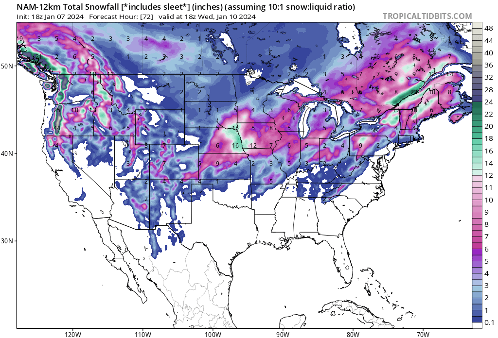
Snowfall Totals and Rain Totals
Snow totals here are slightly overdone, but you can see the bullseye of this storm:
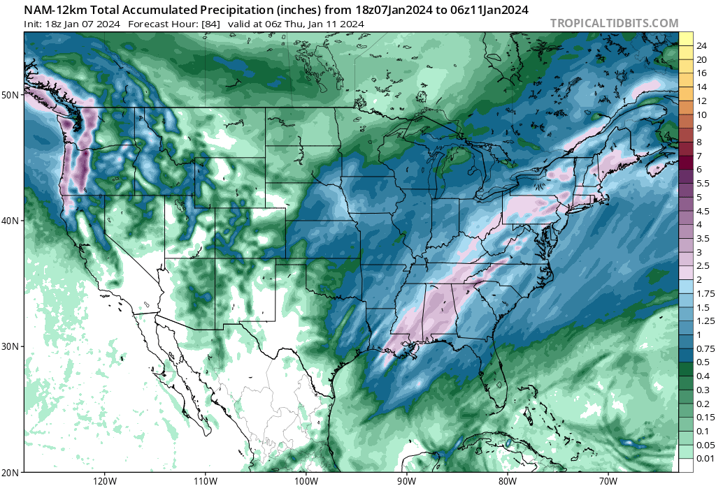
Moderate risks of excessive rainfall have been put out for tomorrow and Tuesday as well for a portion of the Deep South (New Orleans area and just north and west of the NYC/Philly metro area).
A widespread swath of 1-3 inches of rain is looking likely up and down the whole East Coast with localized heavier amounts.
Storm One After Another - Arctic Blast to Move In
Now that was just the first storm. Cold air should remain in place for much of the Northern parts of the US. As for snow in the South, things must line up perfectly - we will miss before we hit. Statistically late Jan and into Feb are the snowiest times for the Southern part of the country during an El Nino.
Things are setting up for that as potent arctic air will move into the US next week.
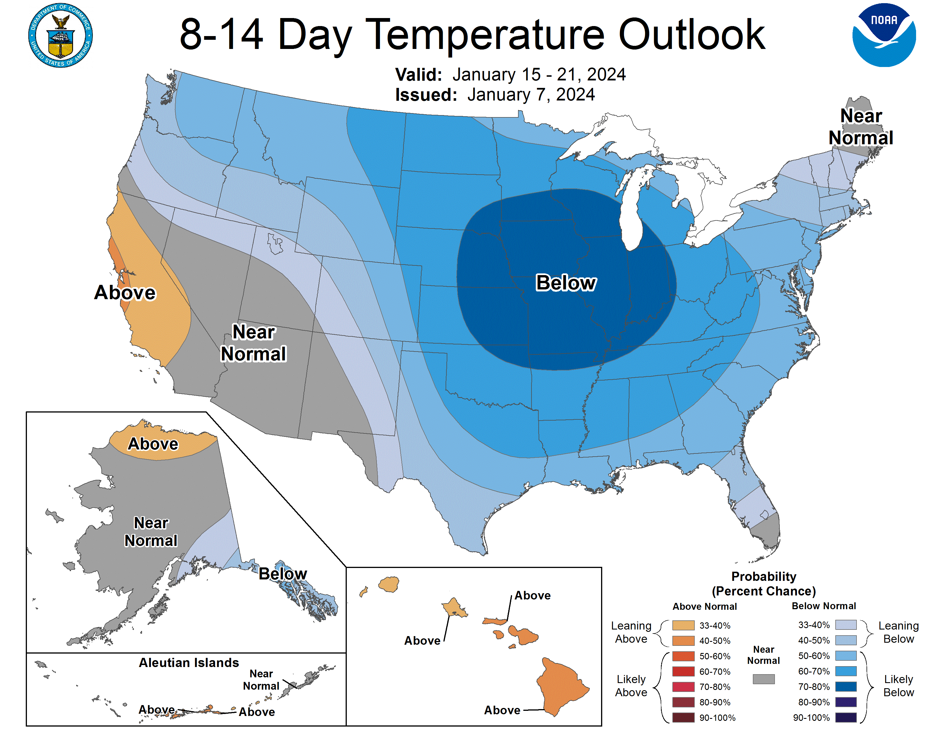
Official 8-14 day temperature outlook shows a huge blast of cold air moving into the Central US which will likely move eastward further out into the future. Once the cold air plunges down, it will have nowhere to go but east.
This will set up a pattern for more storms, one of which could be the snowmaker for the South. Right now we are still a bit too far out to pinpoint where these storms will affect, but here is a cool model run of the next 384 hours - take all of this with a grain of salt.
Stay tuned and subscribe - don’t forget to like and share :D